The counties of North Carolina evolved from the original British colonies, where the concept of “shires” (similar to counties) was adopted and implemented as a way to organize and govern newly established settlements. The boundaries of these counties were adjusted often over time based on population growth and geographic needs.
In 1760, the area that is now Cleveland County was part of Anson County. As the map below shows, it had no western boundary.
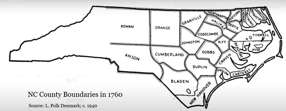
In 1762, part of Anson County was ceded to form the new county of Mecklenburg. Then in 1768, the portion of Mecklenburg County west of the Catawba River was ceded to form Tryon County. Due to surveying errors, parts of “upcountry” South Carolina were included within the boundaries of Tryon. Tryon County was dissolved as a county just 11 years later.
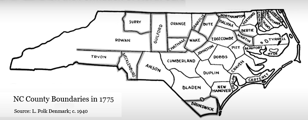
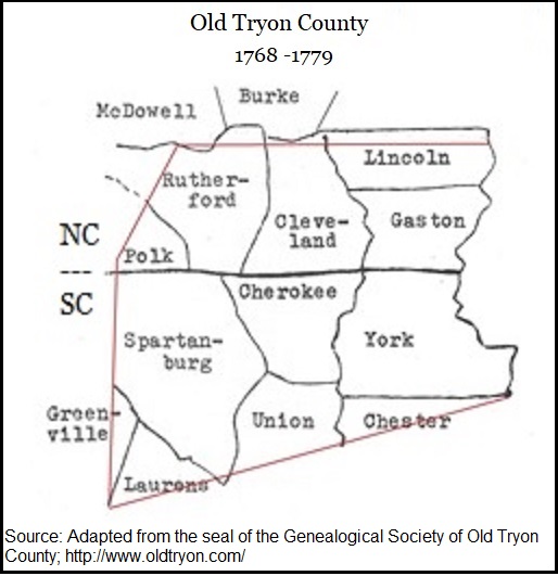
In its place, Rutherford and Lincoln Counties were created. Their north-south boundary line was drawn just west of Buffalo Creek.
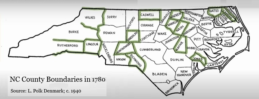
After the American Revolution and the colonies became states, the existing colonial administrative divisions became the foundation for county structures within the newly formed states.
By 1836, several more counties were created around Rutherford and Lincoln counties. The county seats in the two counties were very far apart. Travel by horseback or wagon would have been a burden for anyone living in the middle.
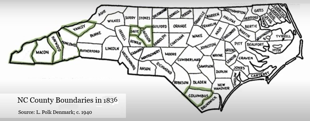
Many in the midst of this area began to recognize the need for more localized governance and representation for residents in this growing region. On September 22, 1836, several people met at the home of Teter Beam.1 With this meeting, the campaign for a new county was launched.
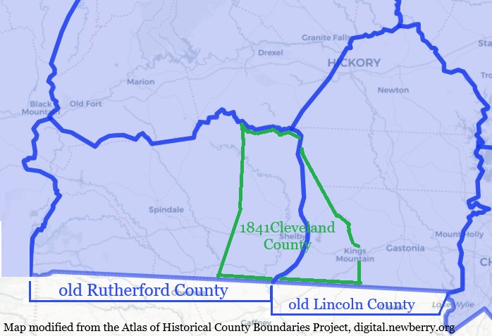
It took five years and two legislative rejections before the new county was finally approved by the North Carolina legislature. The bill to create a new county from an eastern portion of Rutherford County and a western portion of Lincoln County was introduced by Dr. W. J. T. Miller of Rutherford County on January 11, 1841. This time the bill passed. The new county was named for Col. Benjamin Cleveland, a formidable Patriot commander during the Battle of Kings Mountain.
The map below shows the new Cleveland County overlaying the old Rutherford and Lincoln Counties.
Cleveland County’s formation took place during a period of expansion and development in North Carolina. With the arrival of new settlers and the establishment of agriculture as the backbone of the economy, the area quickly began to thrive. The county’s landscape, characterized by rolling hills and lush valleys, provided ideal conditions for farming, which attracted more residents.
Today, Cleveland County is known for its rich history, charming communities, and natural beauty, making it a unique part of North Carolina’s tapestry. The creation of the county in 1841 marks a significant milestone in the region’s development, reflecting the larger narrative of American expansion and the pursuit of community representation.
The number of counties in North Carolina has grown from two to 100. In the interim, some early counties became extinct, while others were absorbed, ceded, or created from existing counties of the time, as was the case for Cleveland County.
Watch this video to see how the NC map of counties evolved over a 200-year span of time.
1700 – 1912
For more information, click on the book cover below to visit The Internet Archive. This link provides free access to David Leroy Corbitt’s book on the formation of NC counties.

For additional information:
The History of NC County Government
Little Known History of Carolana
- John Teeter Beam (1732-1807) was a prominent German immigrant who lived in the western portion of Lincoln County. His son was Teter Beam (1795-1884), but he also had a grandson named John Teeter Beam (1812-1874). It is assumed the meeting took place at the son’s residence. All three are buried at the New Prospect Baptist Church cemetery. ↩︎

