Currently, there are seven unincorporated, named communities in Cleveland County: Delight, Double Shoals, Hillsdale, Light Oak, Toluca, Woodbridge, and Zion. Light Oak is also a census-designated community. Some of their histories are listed below under their respective township number.
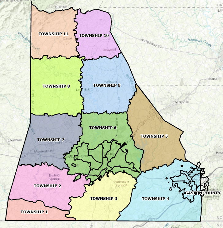
In the past there have been dozens of named communities and post office stops across the county. Many of the “post offices” were operated out of someone’s home or store. Those known are listed below under their respective township number. Townships were established in 1868. They were numbered, but also given names early on.
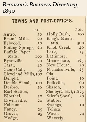
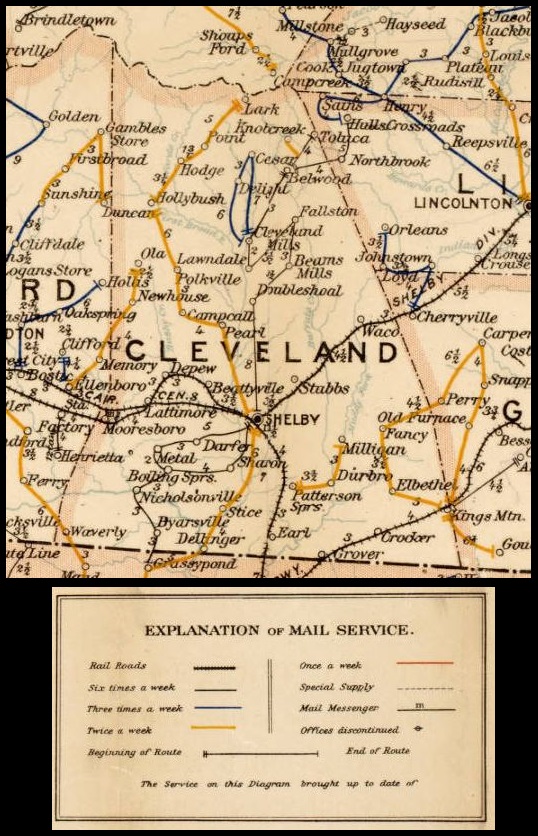
The 1890 Branson’s Business Directory included a population table. As the table shows, there were not many people in these small communities in 1890. The business directory did not include the population of the rural areas. The total population of Cleveland County in 1890 was 20,394.
Township No. 1, River
Former Communities:
- Byarsville was across the Broad River at the Byers family cemetery.
- Erwinsville had a post office at the Ellis Ferry.
- Folger was west of Byarsville.
- McCraw was just east of Byarsville.
- Waverly was in the southwest corner of the county near Prospect Baptist Church.
The Grassy Pond post office was on a postal route that served Cleveland County, but it was actually across the South Carolina line. Lee Weathers told the story of George Magness coming close to drowning as he crossed the Broad River trying to deliver mail to the Grassy Pond post office.
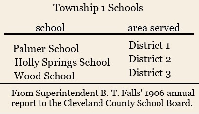
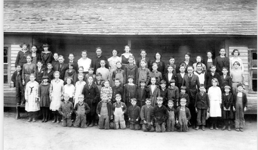
John W. Wood wrote about the existence Cobb School, a one-room school in Township No. 1. He recalled three two-room schools–Holly Springs, Palmer, and Prospect. In 1936 these three schools were consolidated to form a new school named No. 1 School. This school served the area until its closure in 1963, after which students were bussed over to Boiling Springs. The building was converted to a rug manufacturing business.
Township No. 2, Boiling Springs
Former Communities:
- Cabot was just south of the Sharon community.
- Kossie was about halfway between Boiling Springs and Sharon.
- Metal had a post office in the C. J. Hamrick store at Boiling Springs.
- Nicholsonville had a post office on the river road at A. J. Settlemyre’s Ferry.
- Sharon was about three miles east of Boiling Springs; it had a post office.

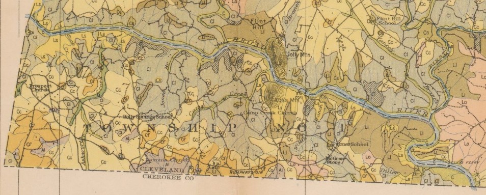
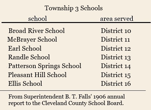
Township No. 3, Rippy’s
Former Communities:
- Durbro was near Pleasant Hill Church between Patterson Springs and Kings Mountain.
- Stice Shoals
- Swangs became Patterson Springs.
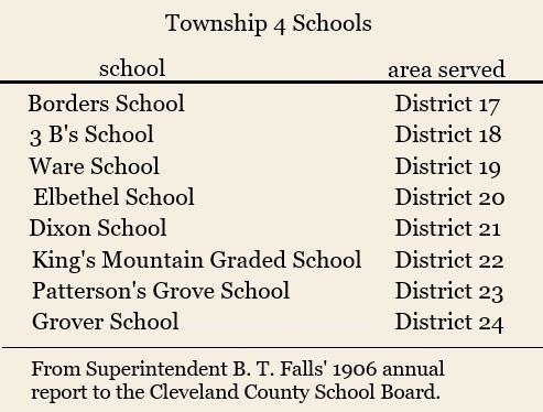
Township No. 4, Kings Mountain
Former Communities:
- Crocker was about halfway between Kings Mountain and Grover.
- Elbethel was just northeast of Kings Mountain.
- Neals was in the Oak Grove area.
- Whitaker became Grover.
- White Plains became Kings Mountain.
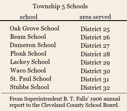
Township No. 5, Warlick
Woodbridge is an unincorporated community on the southeast side of Moss Lake. Its development began in the early 1970s when the city of Kings Mountain received a grant to dam Buffalo Creek to create the lake. The original developer of Woodbridge, Jim Hamrick, built a social club with a pool, tennis courts and clubhouse to complement the golf course. Currently there are close to 300 homes in Woodbridge.
Former Communities:
- Buffalo Paper Mill was built at Stubbs.
- Fancy was located between Muddy Fork and Potts Creek.
- Milligan was west of Fancy.
- Old Furnace, near Fancy, may actually have been across the Gaston County line.
- Stubbs was on the north side of the Cherryville Road at Buffalo Creek.
The Perry post office was on the postal route that served Cleveland County, but it was actually across the Gaston County line.
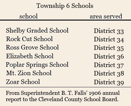
Township No. 6, Shelby
Hillsdale is an unincorporated community just southeast of Shelby on Sulphur Springs Road. Its development began in the 1960s.
Light Oak is a census-designated, unincorporated community east of Shelby. It developed from rural farmland into a residential area primarily during the late 1950s and 1960s. Currently there are close to 700 residents in the community.
Zion is an unincorporated community just northwest of Shelby. The community’s identity is primarily tied to Zion Baptist Church, which was established in 1816.
In the history of Township No. 6, there were no other towns or communities with post offices other than Shelby.
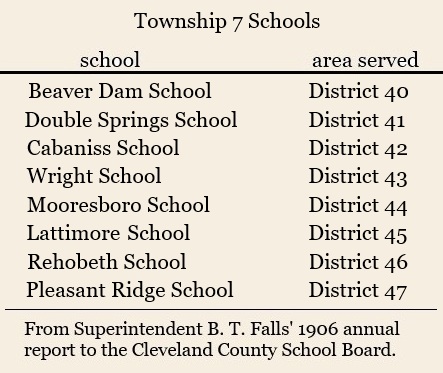
Township No. 7, Sandy Run
Former Communities:
- Autro was near “Duncan’s Old Fields” close to Rehobeth Church near New House. The postmaster there was J. N. Washburn.
- Beattyville was named for its postmaster, Monroe Beatty; it was east of DePew.
- Darfer, named for Darfer Hamrick, was located in the Beaverdam section.
- DePew, named for Senator Chauncey DePew, was near Washburn Switch on the railroad line. The train did not stop here, so mail was thrown off as it went by.
- Young’s, possibly northwest of the Town of Mooresboro.
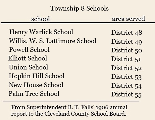
Township No. 8, Polkville
Delight is an unincorporated community about a mile southwest of Clover Hill United Methodist Church. It is named in old maps as early as the 1880s.
Former Communities:
- Bead was located between Polkville and Lawndale.
- Camp Call was operated by M. M. Mauney and was near the R. E. Campbell store.
- Humid was located between Camp Call and Double Shoals.
- New House once had a post office that was about five miles southwest of Polkville.
- Ola had a post office between Polkville and New House. It was operated by Squire James Beam.
- Pearl had a post office that was just southeast of Camp Call; it was operated by Hamp Simmons.
The Duncan’s Creek and Memory post offices were on the postal route that served Cleveland County, but they were actually across the Rutherford County line.
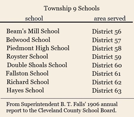
Township No. 9, Double Shoals
Double Shoals in an unincorporated community just south of Lawndale. Its development began in 1855 when the Double Shoals Cotton Mill was built.As the county’s first cotton textile mill, it served as a hub for textile production, including yarn and cloth, before closing in the 1980s, with the site now being repurposed as a special events venue. The name Double Shoals was derived from the presence of two shoals in the First Broad River at that location.
Former Communities:
- Beam’s Mills was in the Pleasant Grove Baptist Church area just south of Fallston.
- Black Rock became Belwood.
- Cleveland Mills was located on Knob Creek just above its confluence with the First Broad River north of Lawndale.
- Love Joy
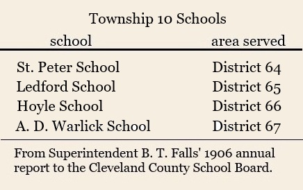
Township No. 10, Knob Creek
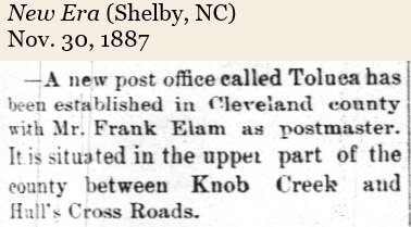
Toluca is an unincorporated community that straddles Cleveland and Lincoln Counties. The community is situated near the intersection of NC Highways 18 and 27. It is known for Knob Creek Orchards which grows several varieties of apples. Red Bone Willy’s Trading Company is also a popular destination.
Former Communities:
- Knob Creek
- Shade
- Paso
- Zite was short for monazite, an important mineral mined in the county.
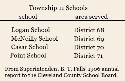
Township No. 11, Casar
Former Communities:
- Hodge was west of Casar.
- Holly Bush was at “Jack Martin’s mill.”
- Lark was in the Mt. Moriah section west of Casar.
- Point had a post office just west of Casar.
Cleveland County’s small post office communities began to disappear after the establishment of the Rural Free Delivery program passed by the federal government in 1896. Rural Free Delivery began in Cleveland County in 1902.
Many thanks to Aaron Senter, GIS Coordinator of the Cleveland County Planning Department for his assistance in collecting and sharing old Cleveland County township maps.
