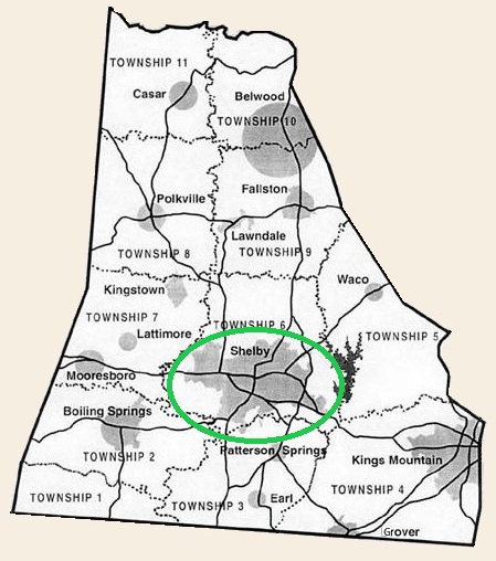
The County Seat
The 1841 act of the NC General Assembly that created Cleveland County stipulated that a county seat be established “not more than four miles from Wilson’s Mineral Springs.” This was due to the fact that Wilson Springs was widely known and its location was already near the center of the new county.
The Cleveland County Court appointed a committee to settle on a site for the county seat. Its members were: Samuel Andrews, Edmund Bryan, R. H. Burton, H. Cansler, Achilles Durham, David Gray, Eli Hoyle, Alex McCorkle, and John McDowell.
There were two opposing coalitions debating the issue. One group lived on the east side of the new county in the area that had been part of Lincoln County. This group proposed the new county seat be located near the Stubbs Railroad Station. Members of this group were Joshua Beam, Robert Falls, William Graham, Samuel Oates, and John Roberts.
An opposing group lived on the western side of the new county in the area that had been part of Rutherford County. They violently opposed the Lincoln group’s proposal. Members of this group were Samuel Bailey, Young Brisendine, George Cabaniss, William Covington, and Thomas Roberts.
The Lincoln group made a counter offer of locating near Elizabeth Church as a compromise. Still the Rutherford group was opposed.
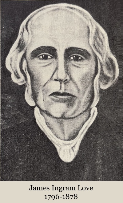
Two men stepped in with offers to donate land for the new county seat. In a deed dated June 18, 1841, William Forbes donated 50 acres. James Ingram Love donated 150 acres; deed dated Aug. 11, 1841.
With the acceptance of these offers, the court then appointed a six-man committee to plan the city: Samuel S. Gidney, Surveyor, John B. Harry, John R. Logan, Green B. Palmer, William Oates, and John K. Wells. At the request of Gidney, Logan, and James Love, the main streets around the center of town were laid out extra-wide for those days. The three of them had visited Washington, D.C. and been impressed with the streets there. It was also decided the main city streets be named for Revolutionary War heroes–DeKalb, Graham, Lafayette, Marion, Morgan, Pinckney, Sumter, Warren, and Washington.
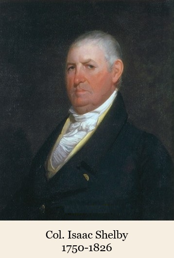
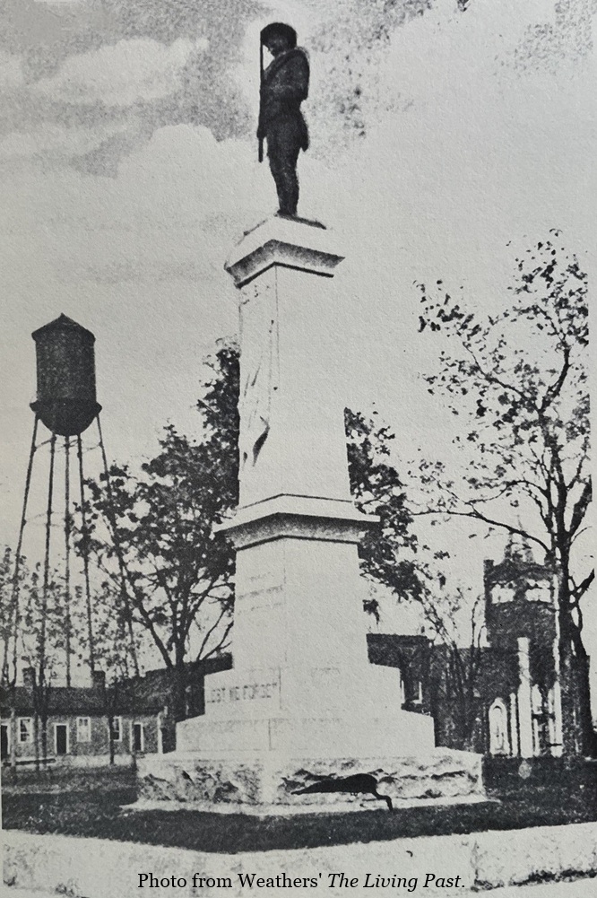
City leaders opted to follow the lead county leadership had set when they named the new county after Revolutionary War hero Col. Benjamin Cleveland. The new county seat was named for Col. Isaac Shelby, another hero of the 1780 Battle of Kings Mountain.
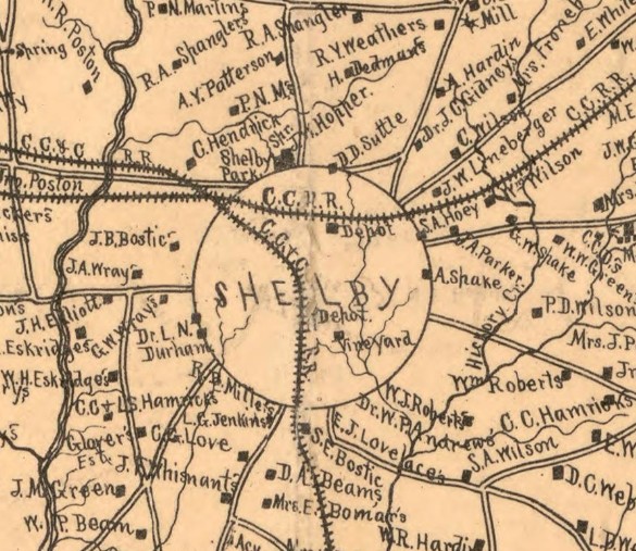
The first boundary for Shelby was drawn as a circle extending one quarter mile in radius from the center of town where the courthouse would be built. At that time the land that would become the court square was a corn field and the land just west of what would later become the First National Bank block was a cow pasture; the rest of Shelby was woodlands.
City lots were laid off and sales began in October of 1841with an auction conducted by John Bishop Harry. At the first sale held, 50 of the 160 lots were sold. Lots facing the square went for prices ranging from $391 to $699; most residential lots went for $70.
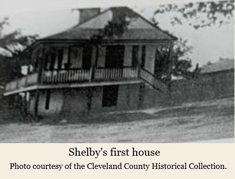
The first structures built around the court square were frame houses and stores. The image below is reportedly Shelby’s first house located where the Central Methodist Church now stands on Washington Street. It was built by William P. Jackson, the county coroner at the time. He used the front portion for a store; living quarters were in the back portion. According to Jackson’s daughter, Minnie Lee Jackson Williamson, her uncle, Jim Jackson, built Shelby’s second house. None of the 19th century frame homes and buildings fronting the court square exist today.
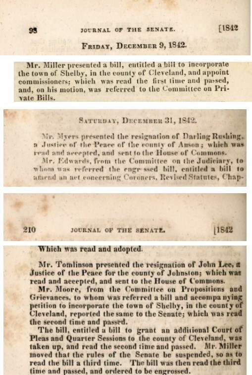
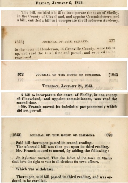
The town of Shelby was chartered on Jan. 25, 1843. In Section 1 of the charter, a Board of Commissioners was named. This first board consisted of Richard Champion, Thomas Cooper, A. R. Homesly, Dr. W. W. Morris, and Dr. Thomas Williams.1
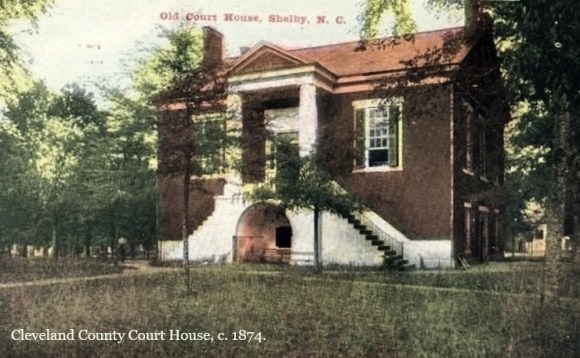
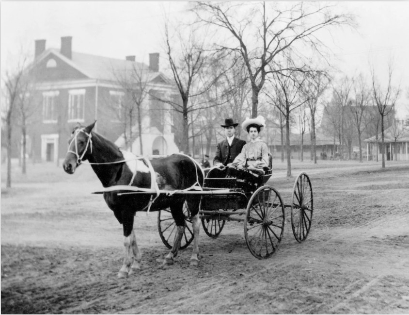
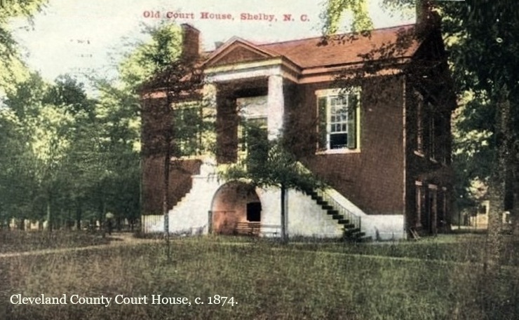
A new brick courthouse was built in the center of Shelby in 1845, replacing the old temporary log structure located elsewhere in town (location unknown). It was built by George Smith and John Dameron in the Greek Revival style. It served the county until 1907.
After the Civil War and the arrival of the railroad in the mid-1880s, Shelby’s economic future looked bright. A promotional booklet, “A Brief Sketch of Shelby: A Thriving Town in the Piedmont Section of North Carolina,” was published in 1889 by Clarence Frick.
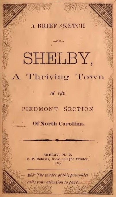
Only two authors are mentioned in the compilation–L. E. Powers and “B.E.F.” This publication is in the style of a Chamber of Commerce brochure. Half of it describes the town of Shelby in such a way as to attract new residents and businesses. The back half is advertisements and business cards. The entire 66 page brochure can be accessed here.
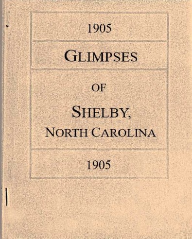
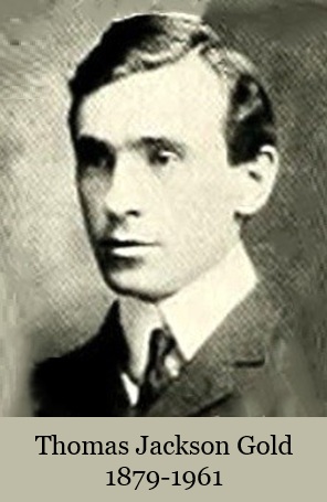
Another booklet was the 1905 “Glimpses of Shelby, North Carolina,” by Thomas J. Gold. It is here.
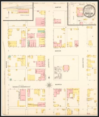
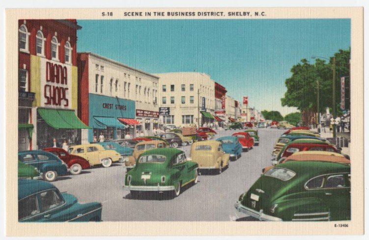
Shelby’s Central Business District
The Court Square. Prior to 1841, this land was planted in corn and was part of the parcel donated by James Love for the establishment of a new county seat.


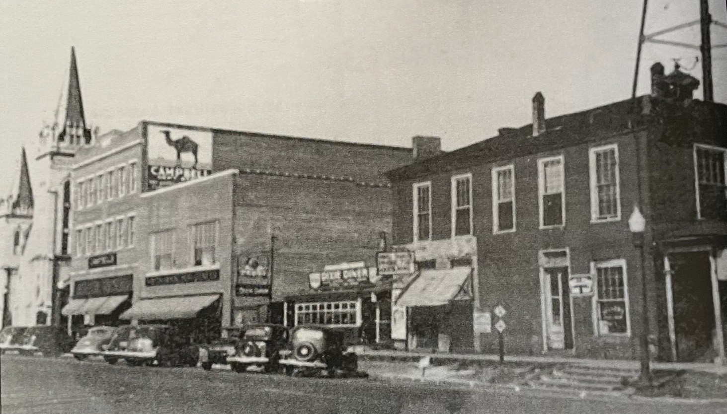
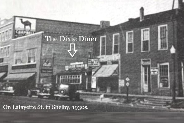
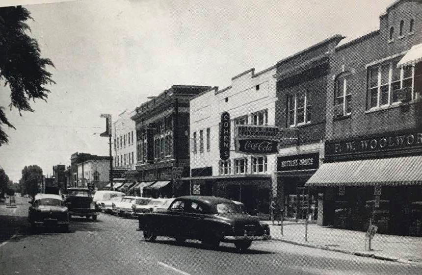
Lafayette Street was named for the Marquis de Lafayette, the Frenchman who volunteered to join the Continental Army during the Revolutionary War. Businesses fronting the court square on its west side are shown below captioned with a little history of each space.
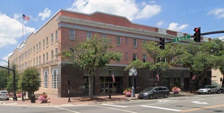
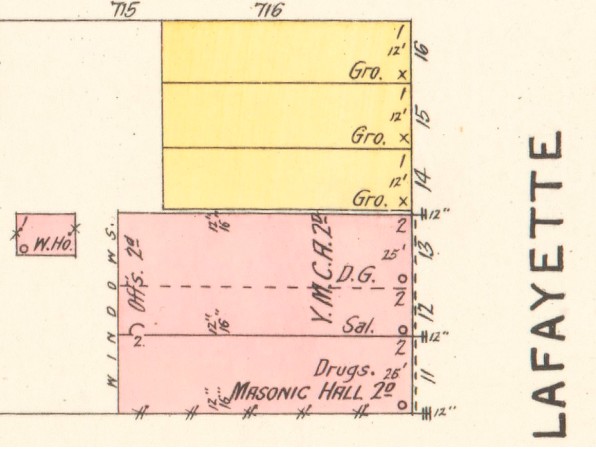
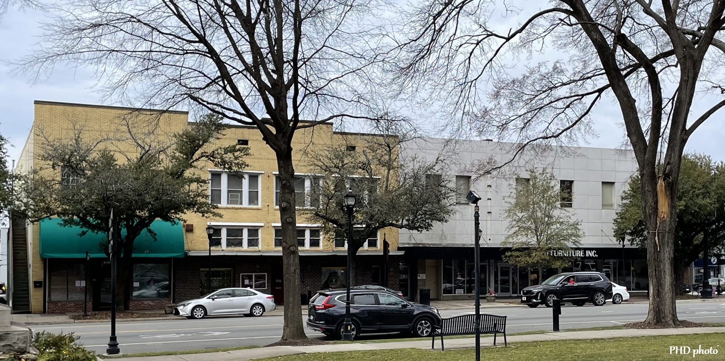
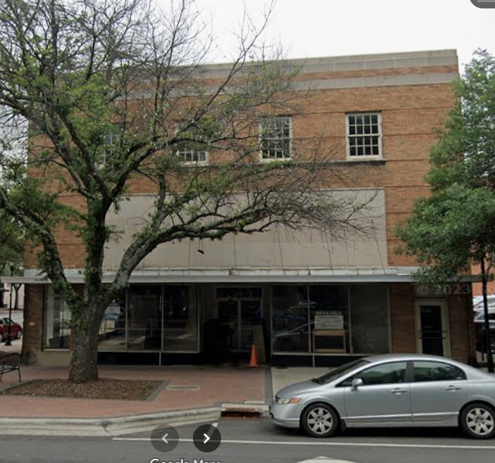
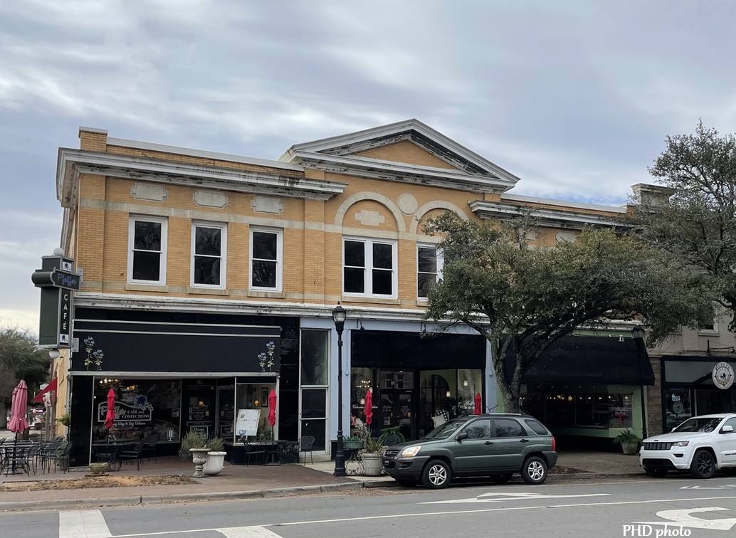
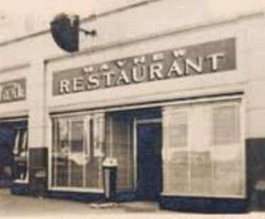
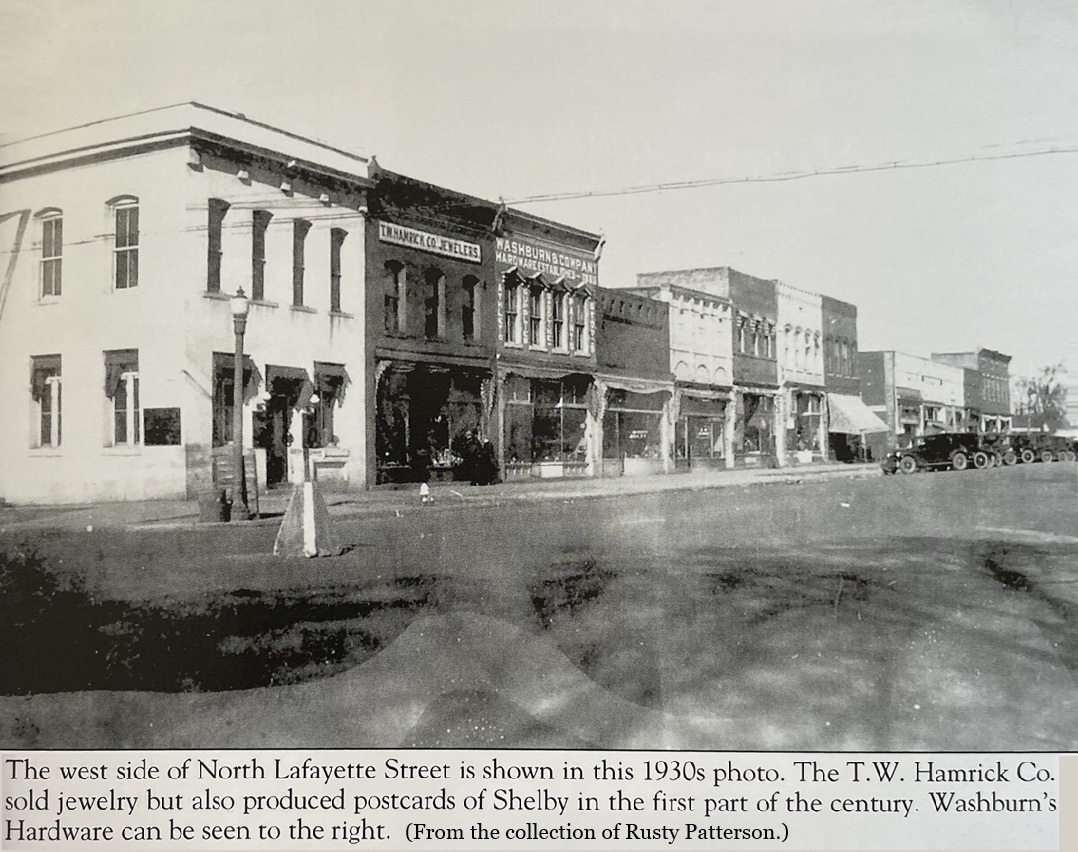
Just across West Dale Street, 1 North Lafayette Street was once the home of the Masonic Temple and the YMCA. Next was the McMurry Hull building which once housed the McMurry Hull furniture store and the J. J. McMurry Cotton Brokerage firm. During the post-World War II era, Cohen’s Department Store operated there. 9 North Lafayette Street was known as the Lineberger Building, at one time housing the Lineberger Hardware Store, Suttle’s Drug Store, and later a Rose’s Store. Currently J and D Furniture operates there.
Marion Street was named for Francis Marion, the “Swamp Fox,” who became a Brigadier General serving with the Continental Army during the Revolutionary War. Businesses fronting the court square to its north follow.
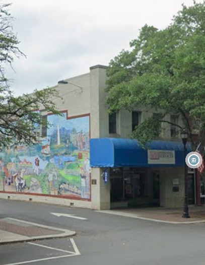
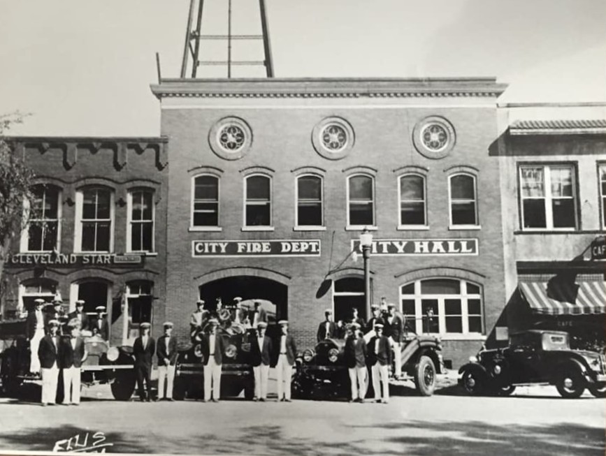
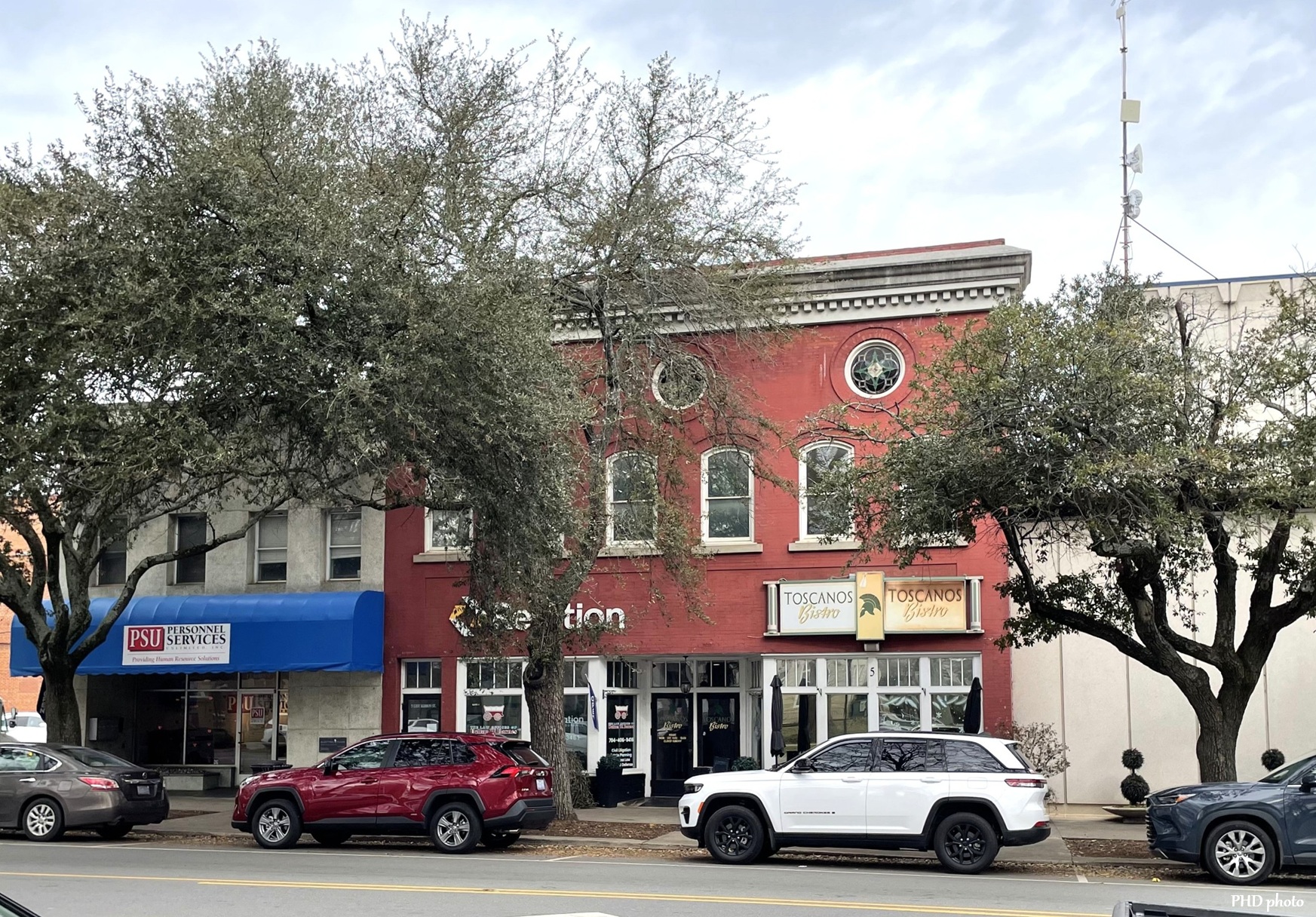
On the corner to the right of North Dale Street is 1 East Marion, currently occupied by Personnel Services Unlimited. This building was once home to the Cleveland Star newspaper, the precursor to the Shelby Daily Star. To its right is currently Toscano’s Bistro, originally built in 1909 by the City of Shelby for its fire department and city hall. Prior to 1909 a one-story house occupied that space. After the city hall and fire department was relocated in 1939, the space housed an A & P grocery store.
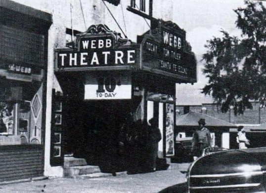
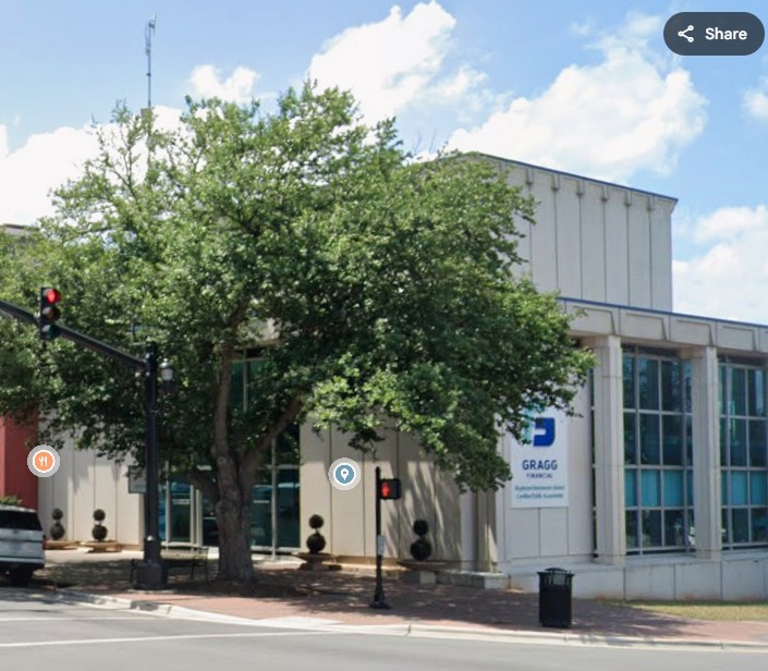
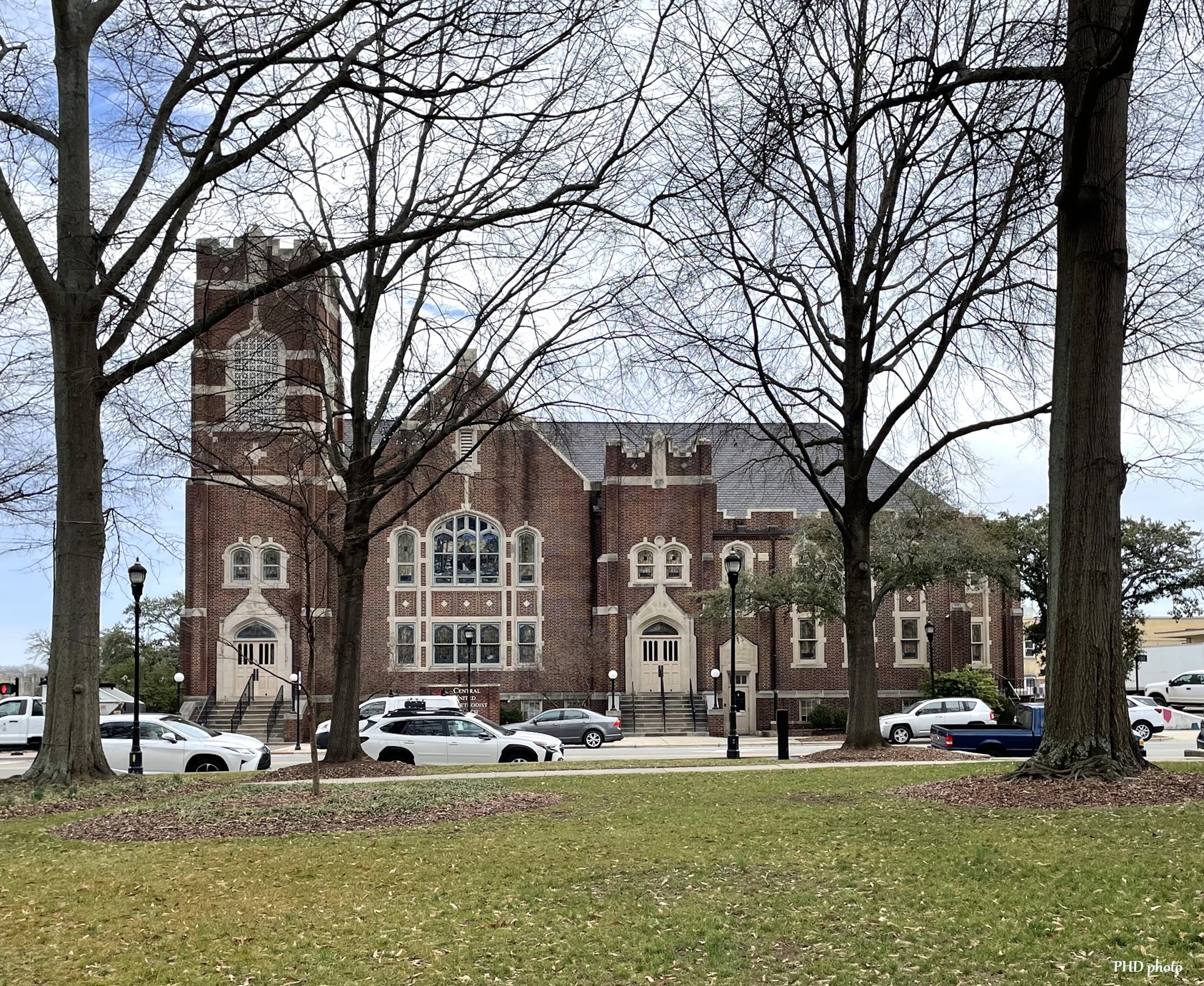
In 1874, Central Methodist Church was built on the NW corner of East Marion and North Washington Streets. When they built a new church (diagonally across the intersection) in 1923, the old church was remodeled to accommodate the Webb Theater. The theater was demolished in 1960 to make way for the Union Trust Bank. Union Trust was acquired by BB&T, and currently Gragg Financial, LLC occupies 9 East Marion.

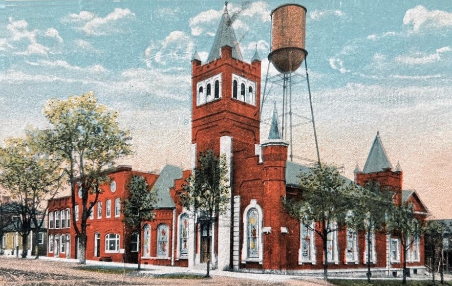
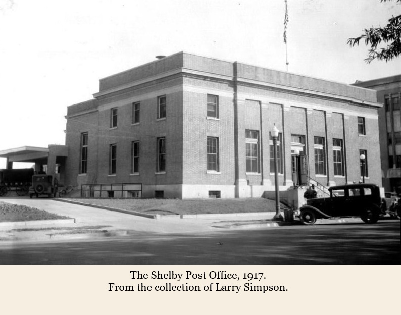
Washington Street was named for George Washington, Commander of the Continental Army and our country’s first president. On the east side of the court square on the SE corner of E. Marion and North Washington Streets is Central United Methodist Church. This Greek Revival church was built in 1924. To its south is the former post office, now remodeled for the Cleveland County Arts Council.

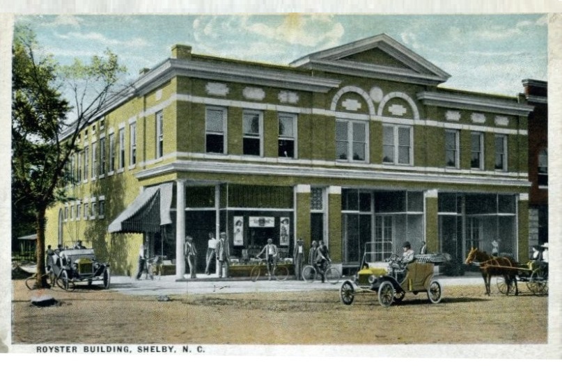
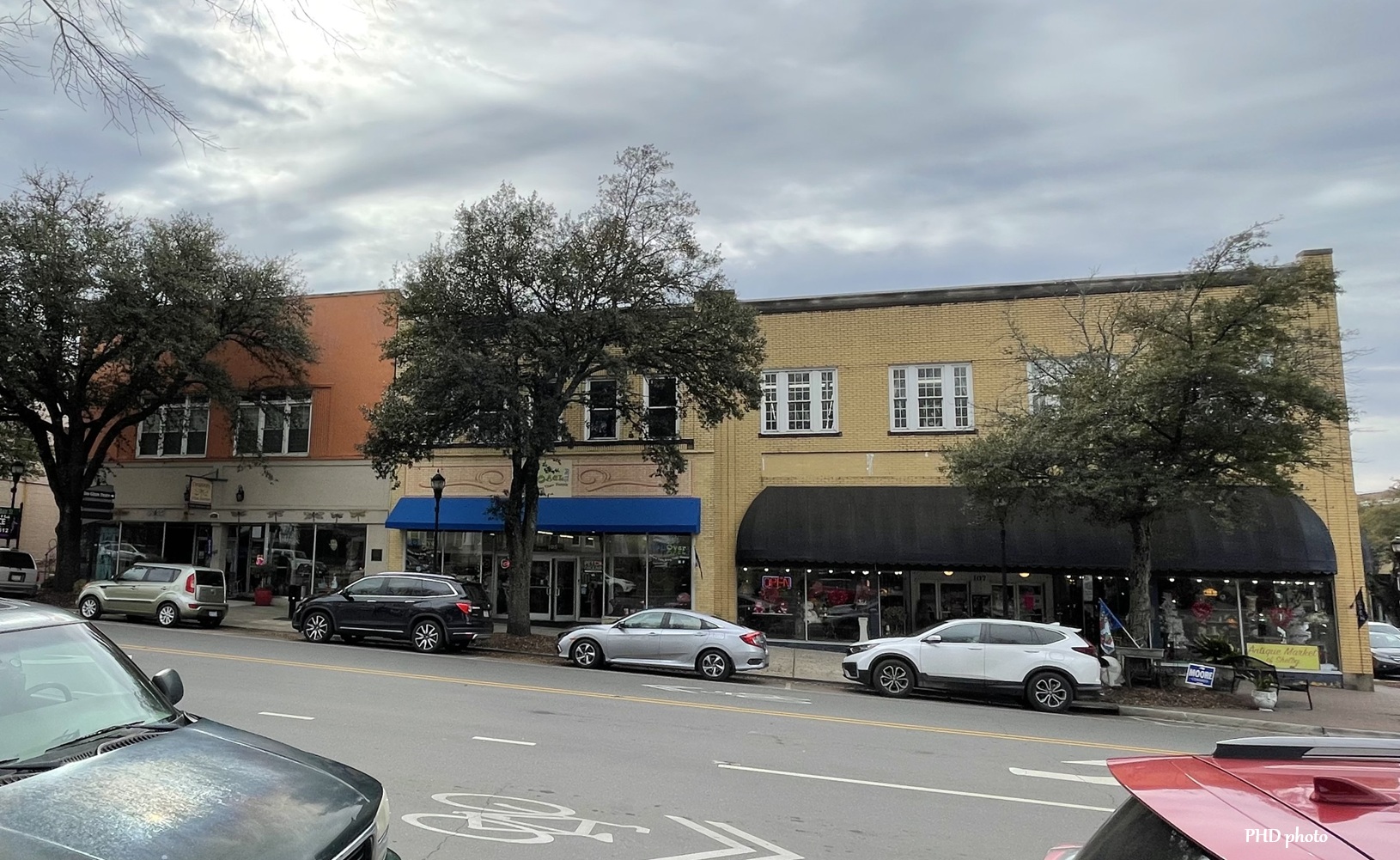
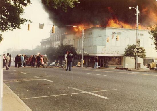
Warren Street was named for Major General Joseph Warren who was killed at the Battle of Bunker Hill during the Revolutionary War. Buildings fronting the south side of the court square are, east to west, the Royster Building, the Webb Building, the Wise Building, Roll Over Pets and the former J. C. Penney’s store. The latter was once the Miller Block, which burned in 1927.

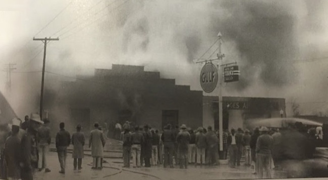
The SW corner of Lafayette and West Warren Streets and further west down West Warren has changed more than once due to tragedies.
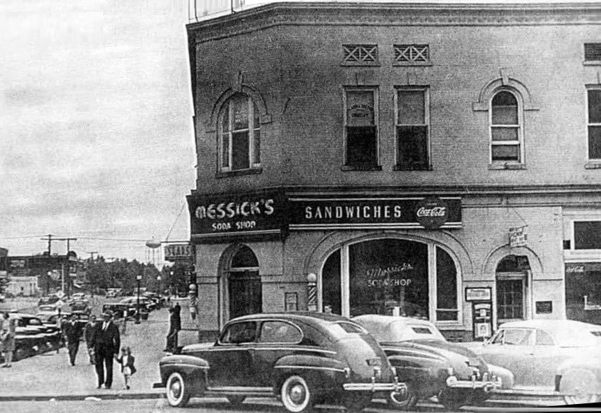

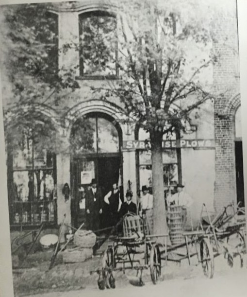
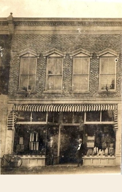
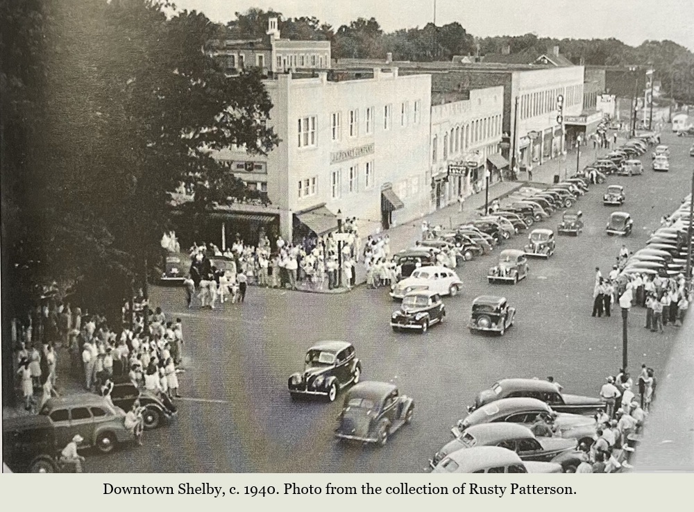
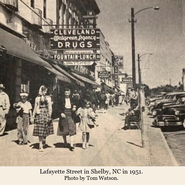
More main streets images from the past. . .
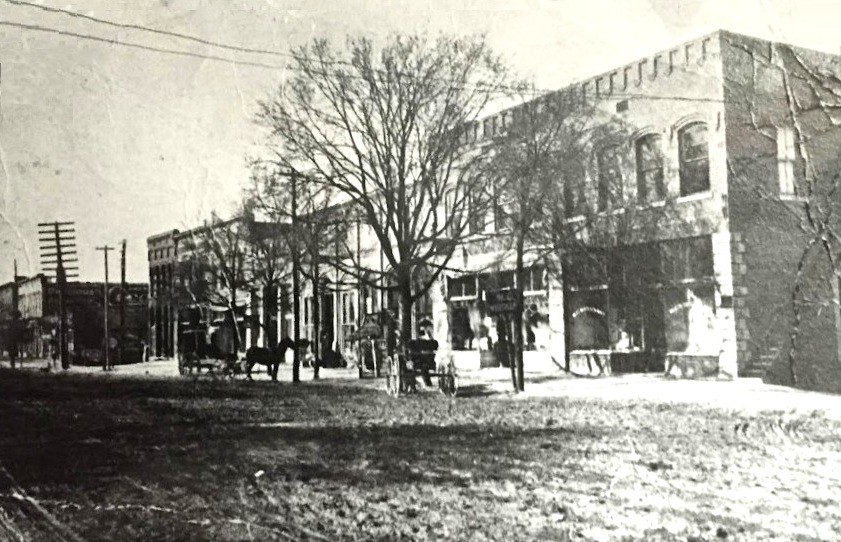
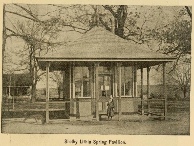
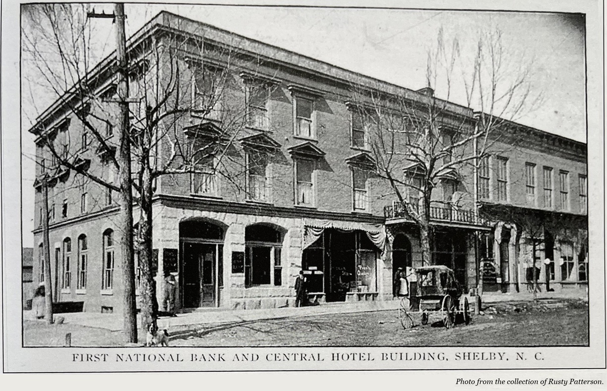
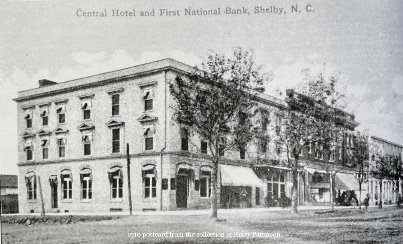
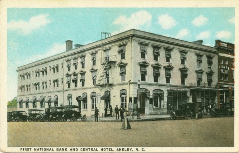
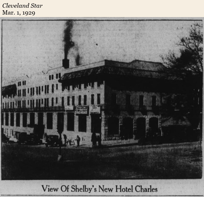
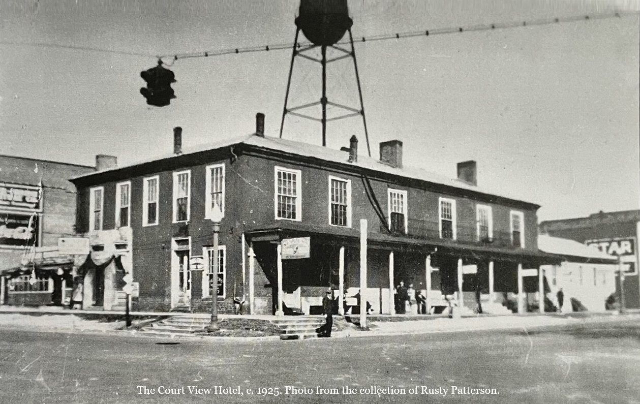
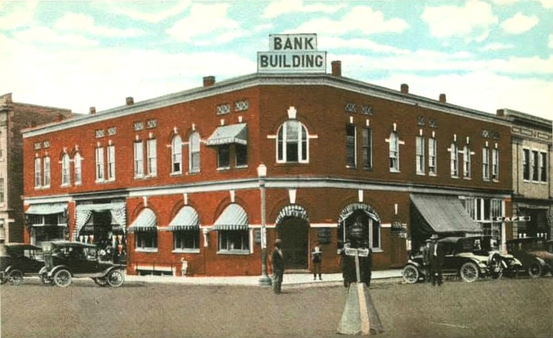
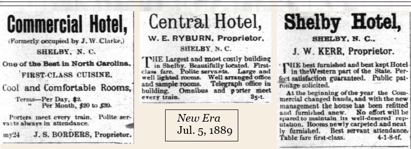
In the 19th century, Cleveland County was a thriving tourist destination due to its mineral springs. Cleveland Springs was the premiere resort for those wanting to take advantage of the health benefits of its spring water. Shelby’s central business district hotels were continually taking the overflow from the hotels at the springs. The Commercial Hotel, which was later named the Court View Hotel, was on the northwest corner of North Lafayette and Marion Streets directly across from the courthouse. The Central Hotel occupied the northwest corner of Lafayette and West Warren Streets.; the Shelby Hotel occupied the southwest corner of East Graham and South Washington Streets.
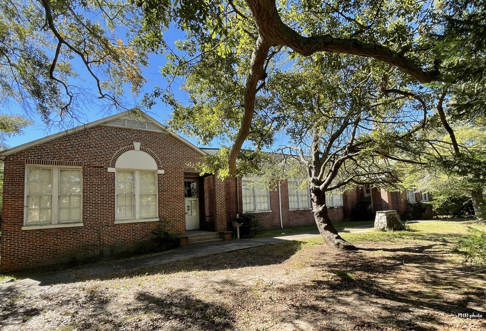
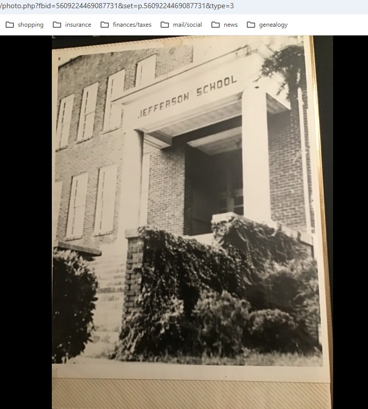
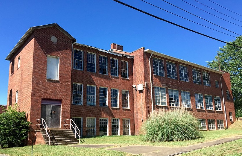
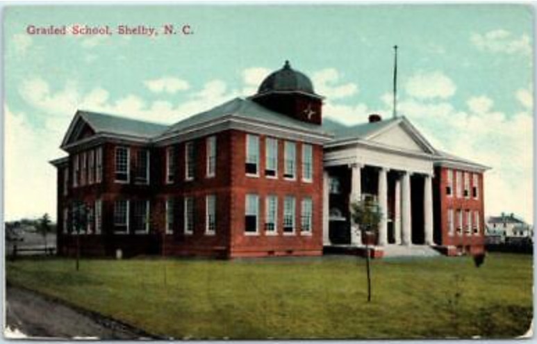
Shelby Schools

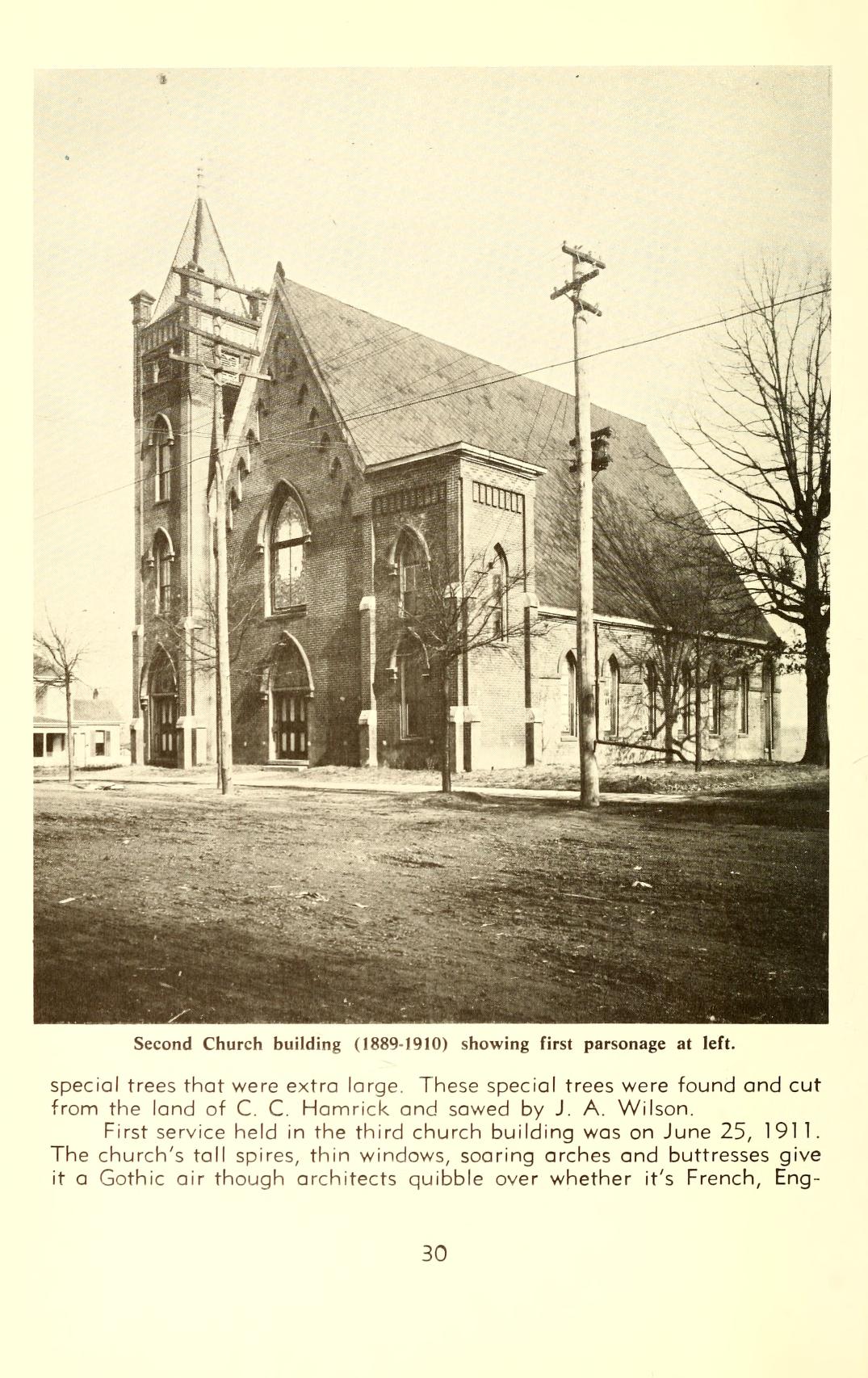
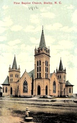
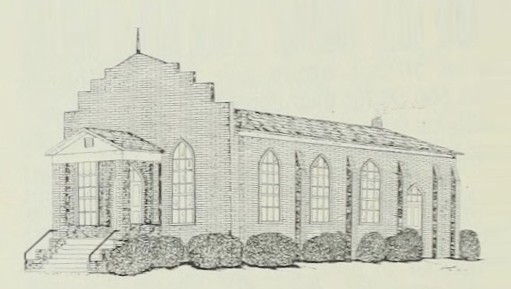
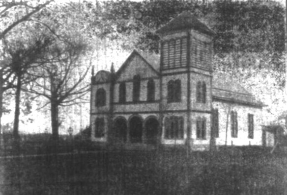
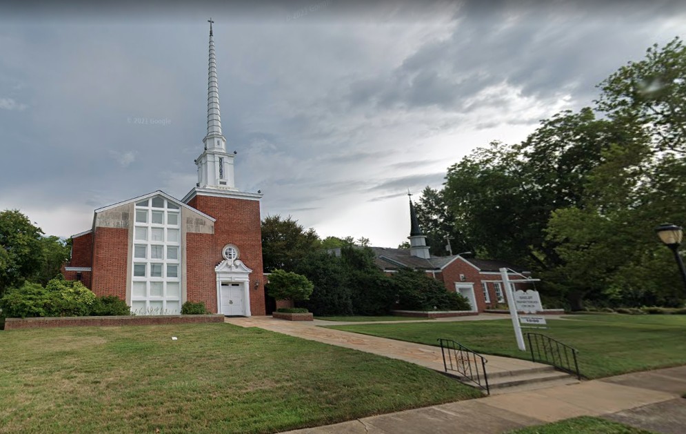
Shelby Churches
Mayors
Some uncertainty exists with regard to Shelby’s first mayor. Research conducted by the late Lee B. Weathers found documentation that Shelby did have a mayor in 1852, but the name was not included. Weathers’ educated guess was that the first mayor was either Frederick L. Hoke (1821-1897) or William Putnam Love (1828-1921).
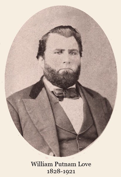
William Putnam Love served six terms as Shelby’s mayor, although the dates of those terms are not documented.
Known mayors are listed in the table below, although the terms of service are unclear for the earliest.
| mayor | term in office |
| Frederick Hoke William Putnam Love Charles Crawford Durham S. L. Gidney J. N. Durham Dr. L. N. Durham John Wells Gidney Andrew C. Miller, Sr. Joseph T. Bostic Joseph C. Smith William L. Dameron | These are the earliest known Shelby mayors. All were born between 1814 and 1860. Their dates of office are unknown. |
| James L. Webb | 1880-1882 |
| William Henry Jennings | x-1905, 1909-11 |
| Joseph L. Suttle, Sr. | 1905-09 |
| Junius Tazewell Gardner | 1911-13, 1915-17, 1921-23 |
| J. C. Smith | 1913-15 |
| Paul Webb | 1917-19 |
| Charles C. McBrayer | 1919-21 |
| William Dixon Lackey, Sr. | 1923-25 |
| Albert P. Weathers | 1925-27 |
| William N. Dorsey | 1927-29 |
| Simeon A. McMurry | 1929-35 |
| Harry Woodson | 1935-51, 1955-63 |
| Clarence King | 1951-55 |
| Hubert Plaster | 1963-76 |
| Lester Roark | 1976-79 |
| George W. Clay, Jr. | 1979-95 |
| Michael D. Philbeck | 1995-2003 |
| W. Ted Alexander | 2003-11 |
| Oliver Stanhope “Stan” Anthony, III | 2011-present |
Shelby Schools coverage under the “Schools” tab.
| Additional Information on Shelby, NC |
| City of Shelby webpage |
| Shelby, NC Wikipedia entry |
| History of Shelby, Carolana website (5 min. read) |
| Historic Shelby Foundation |
| National Register of Historic Places Inventory-Nomination Form for the inclusion of the Central Shelby Historic District, 1983 |
| National Register of Historic Places Inventory-Nomination Form for the inclusion of the East Marion-Belvedere Park Historic District, 2002 |
| Riley, Madge Webb. (1940). “Beginning and Early Days of Shelby.” Fay Webb Gardner Collection, Gardner-Webb University Archives, John R. Dover Memorial Library, Boiling Springs, NC. |
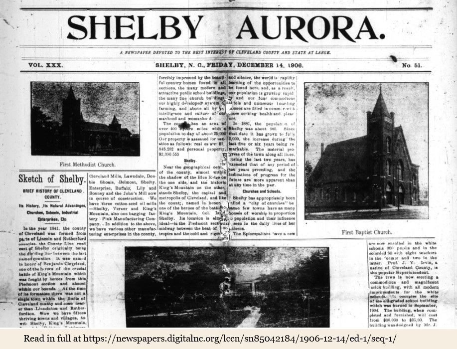
On December 14, 1906, The Shelby Aurora published a special edition highlighting the history and progress of the city of Shelby. It can be read in its entirety at DigitalNC.
Notes
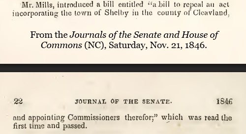
- Three years after Shelby was incorporated, a bill was introduced to the NC State Senate to repeal the act of incorporation; it passed and was sent over to the NC State House of Commons where it passed the following year. Cleveland County historian Robert S. Gidney conducted research into the reason for the repeal of the city’s charter. Writing in Our Heritage, he states, “It appears that the town of Shelby did not immediately exert any governmental authority and the citizens decided to ask the General Assembly to revoke the charter.”
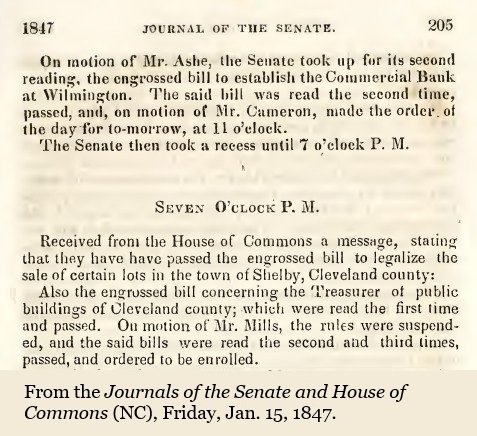
However, in the legislature of 1848-1849, it was revealed that those responsible for the petition to repeal did not even live inside the city limits of Shelby. On January 27, 1849, the city of Shelby was incorporated again. In 1850, another attempt was made to revoke Shelby’s charter; this attempt failed as well.
Another act to incorporate the Town of Shelby was detailed in the Shelby Banner April 8, 1875. This was possibly due to the impact of the Reconstruction Era and the arrival of the railroad; a revision of the structure of city government was needed.
↩︎